MoviSabio Enterprise Smart City
The intelligent neural backbone for modern urban ecosystems. Unifying real-time adaptive traffic signal coordination, edge computer vision, 3D digital twin simulation, and environmental monitoring into an enterprise-grade platform.

Purpose, Operational Value & Target Stakeholders
MoviSabio Enterprise Smart City transforms reactive municipal management into proactive, self-optimizing urban ecosystems. Designed specifically for mid-sized and large metropolitan regions without requiring costly hardware retrofits.
Target Stakeholders & Customers
ENTERPRISE READYTailored for municipal transportation secretariats, smart-city operators, port and logistics authorities, civil engineering firms, research universities, and infrastructure investment funds seeking measurable territorial optimization.
Core Operational Challenges Solved
VALIDATED IN SIMEliminates the three primary bottlenecks of traditional traffic systems: isolated pre-programmed signal controllers that cannot adapt to real-time traffic surges, multi-million-dollar proprietary sensor lock-in, and delayed emergency response routes.
The MoviSabio Value Proposition
SOFTWARE-FIRSTA zero-sensor retrofit, cloud-native platform that taps into existing municipal CCTV cameras via standard RTSP streams and interfaces with standard signal controllers (NTCIP 1202) under strict classical safety boundaries.
Request a Technical Demonstration & Municipal Scoping Call
Our engineering team models your city corridor in the SUMO simulation sandbox to calculate baseline delay reductions before physical deployment.
Initiate Municipal Pilot Inquiry →Traffic Intelligence & Signal Coordination
Combining classical traffic engineering mathematics with modern artificial intelligence to deliver adaptive, multi-intersection signal timing that guarantees vehicular safety and maximizes arterial progression.
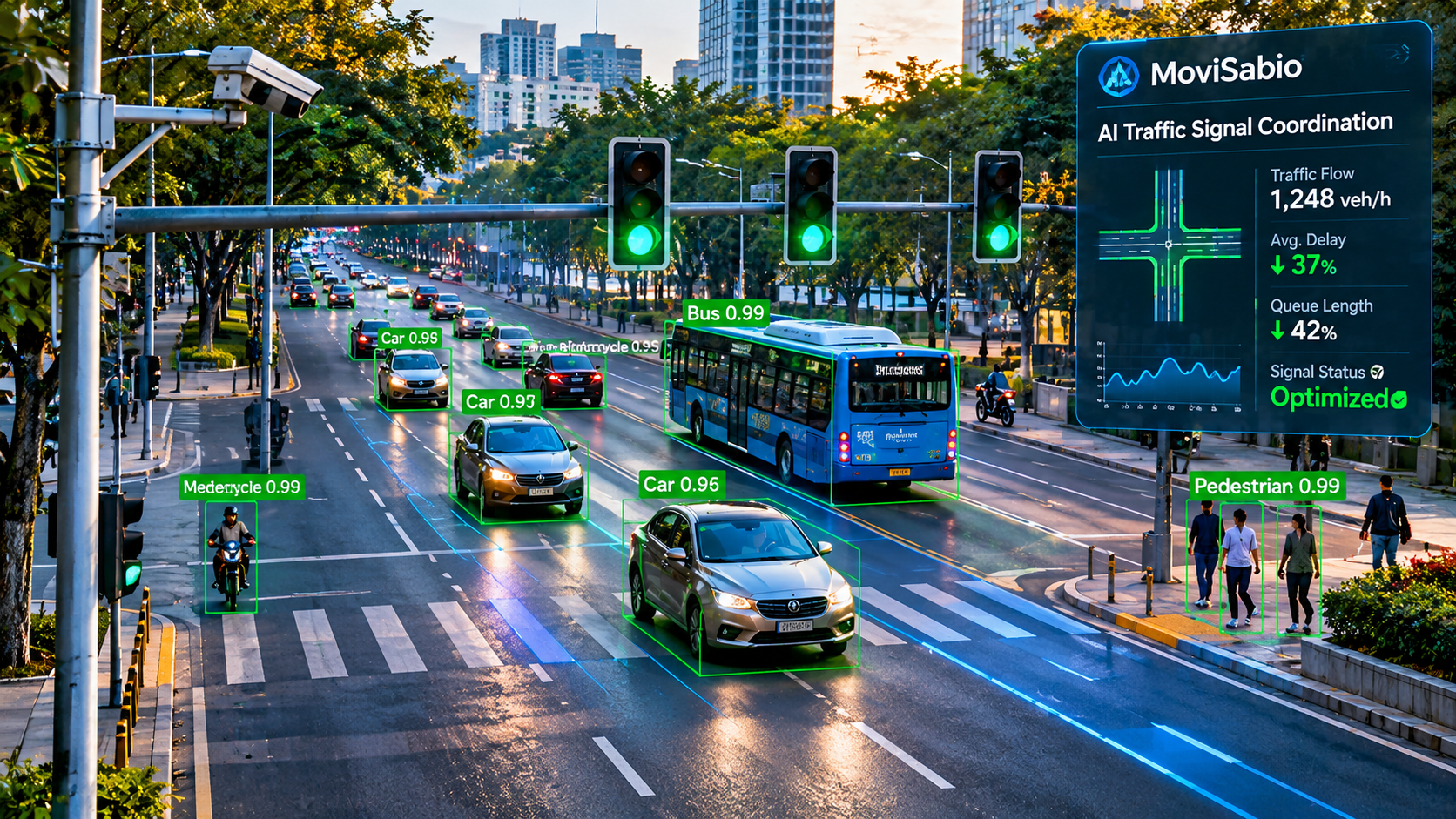
1. AI Traffic Control System (AITCS)
IMPLEMENTED / VERIFIEDDynamically allocates green time to traffic movements exhibiting the highest cumulative delay and queue density. Operates continuously without requiring manual re-timing schedules.
2. Hierarchical Hybrid Framework (MAXBAND + AI)
IMPLEMENTED / VERIFIEDOur core algorithmic innovation: classical MAXBAND linear programming calculates deterministic arterial green waves, while Deep Reinforcement Learning agents adjust local splits within certified safety bounds.
subject to: C_min ≤ C ≤ C_max, red_clearance ≥ min_yellow + all_red
3. Multi-Intersection Corridor Coordination
ACTIVE DEVELOPMENTCoordinates a chain of 5 to 20 consecutive signalized intersections to create bi-directional green waves along primary arterial routes, mitigating shockwaves caused by mid-block queue spillovers.
4. Emergency Vehicle Preemption (EVP)
PLANNEDInterfaces with emergency dispatch Computer-Aided Dispatch (CAD) systems. Preemptively clears downstream vehicular queues and provides a continuous green wave for ambulances and fire engines.
Computer Vision & Edge AI Processing
Transforming existing municipal CCTV and traffic camera feeds into structured, real-time vehicular and pedestrian telemetry without purchasing new physical road sensors.
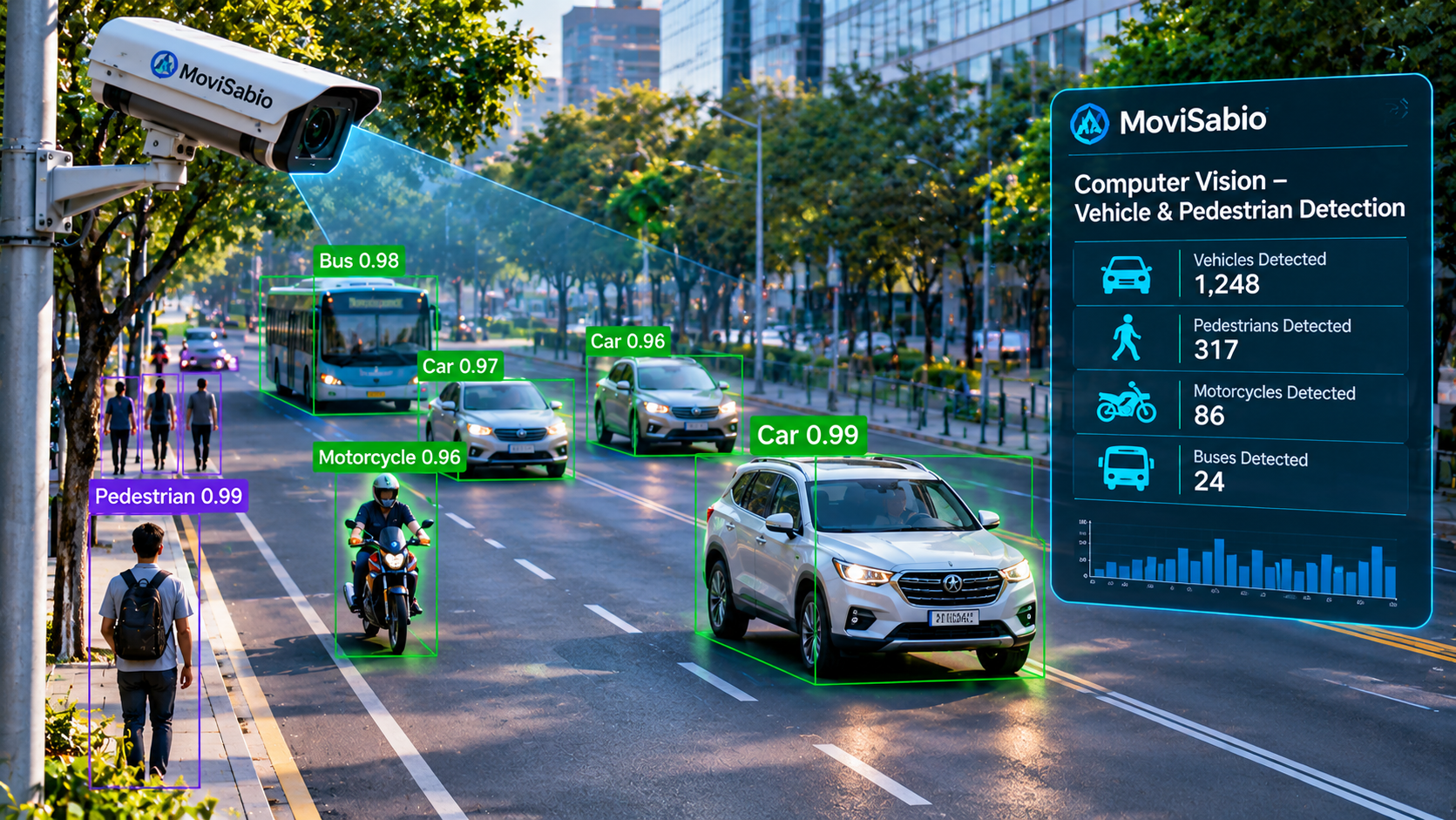
YOLOv8 Real-Time Vehicle Detection
IMPLEMENTED / VERIFIEDProcesses H.264 / H.265 RTSP streams from city cameras. Detects and tracks vehicles with high precision across diverse lighting and weather conditions (sun glare, rain, nighttime).
Lane-Wise Spatial Counting & Speed Tracking
IMPLEMENTED / VERIFIEDDefines virtual polygon detection zones and directional tripwires across approach lanes to compute vehicle density, approach speed, queue dwell time, and Level of Service (LOS).
Edge Deployment & Zero Hardware Upgrade
ACTIVE DEVELOPMENTInference runs locally on ruggedized edge micro-servers installed in signal cabinets, eliminating the cost of streaming gigabytes of raw video to the cloud and ensuring resilience during network outages.
Automatic Number Plate Recognition (ANPR) Roadmap
PLANNED (PRIVACY SAFEGUARDED)Planned capability for point-to-point travel time estimation and municipal security. Strictly engineered with cryptographic hashing and local redaction to ensure GDPR and LGPD compliance.
Territorial Intelligence & Digital Twins
Constructing high-fidelity digital replicas of urban road networks from open geospatial data to validate optimization strategies before physical field deployment.
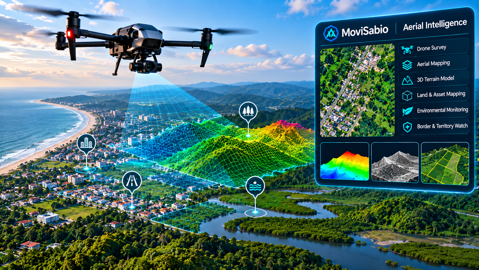
GIS Integration & OpenStreetMap Extraction
IMPLEMENTED / VERIFIEDAutomated spatial ingestion pipeline parses OpenStreetMap (OSM) vector data, extracting road hierarchies, intersection geometries, speed limits, and pedestrian sidewalks into GeoPandas DataFrames.
SUMO & TraCI Closed-Loop Simulation
IMPLEMENTED / VERIFIEDMicroscopic traffic simulator (SUMO) connected via the TraCI Python API. Enables our AI models to step through virtual seconds, observe simulated vehicle queues, and execute phase timing changes.
CARLA 3D Photorealistic Simulation
RESEARCH CONCEPTExploratory integration with the Unreal Engine-based CARLA simulator to test edge computer vision models against synthetic video feeds rendered under extreme fog, blinding sun, and nighttime conditions.
Intelligent Mobility & Public Transit Priority
Enhancing mass transit punctuality, parking efficiency, and pedestrian safety to incentivize sustainable, shared urban mobility over single-occupancy vehicles.
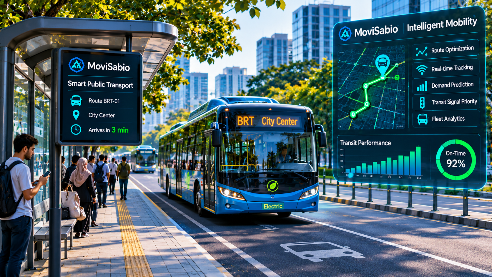
Transit Signal Priority (TSP)
PLANNEDIngests real-time GPS coordinates from municipal transit fleets. Extends green lights or truncates red lights when a delayed bus approaches, targeting a 20–40% improvement in public transit punctuality.
Smart Parking Guidance
PLANNEDMonitors on-street and garage parking space occupancy using computer vision feeds. Directs drivers to open spaces via digital variable message signs (VMS) to eliminate block-circling traffic.
Pedestrian Intelligence & Adaptive Crosswalks
PLANNEDDetects pedestrian crowds, school children, and elderly citizens waiting at crosswalks. Dynamically extends pedestrian clearance phases, ensuring vulnerable citizens cross safely without causing unnecessary vehicle delays.
Environmental Intelligence & Climate Resilience
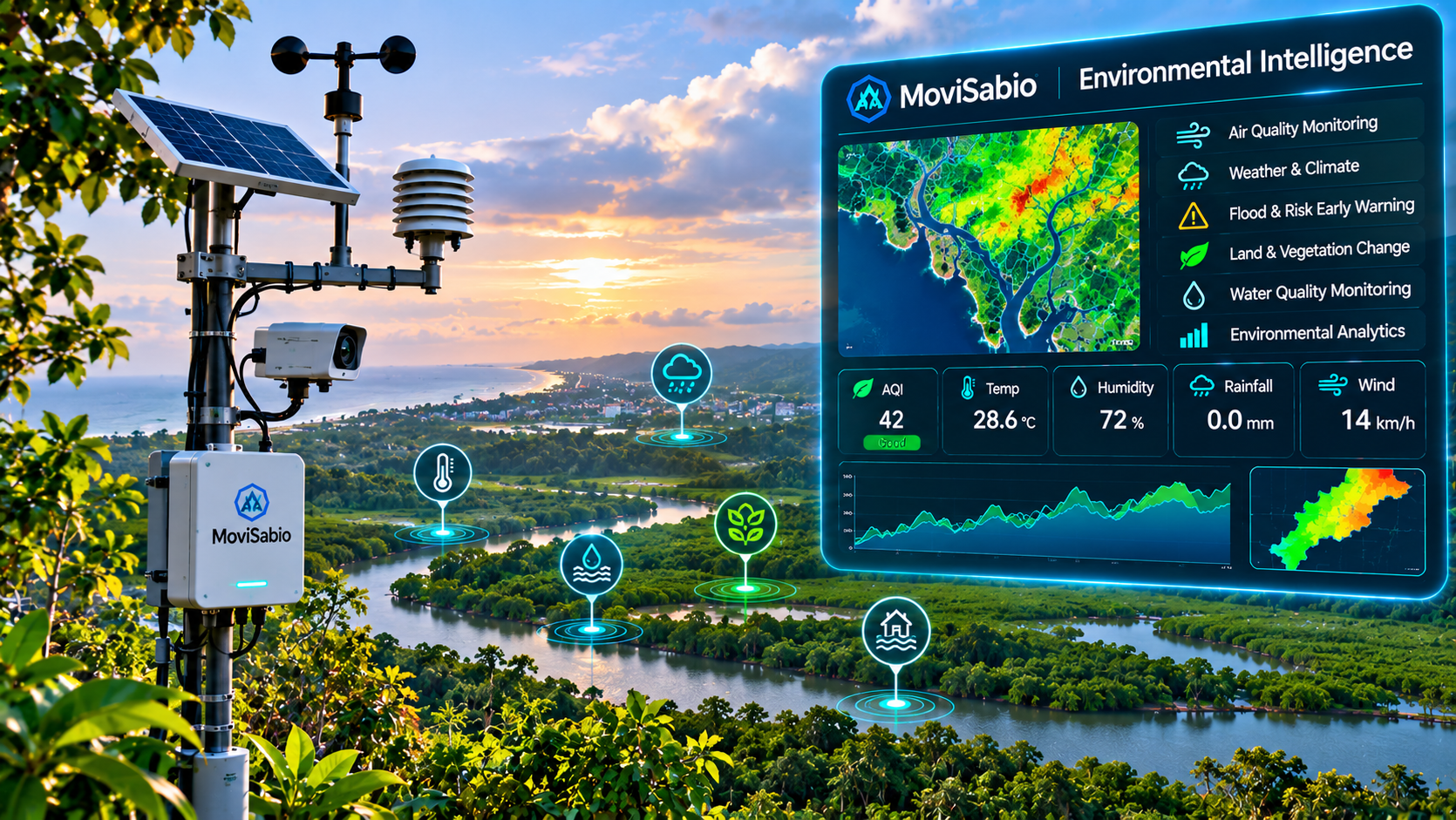
Tracking vehicular emissions, ingesting weather station feeds, and optimizing territorial traffic flows to meet United Nations Sustainable Development Goals (SDG 11 & 13).
CO2 & PM2.5 Emissions Modeling
ACTIVE DEVELOPMENTEstimates real-time greenhouse gas and particulate emissions at congested intersections using vehicular delay logs and vehicle classification ratios (cars vs. heavy diesel trucks).
Weather-Adaptive Signal Adjustment
PLANNEDIngests hyper-local precipitation, road surface temperature, and visibility telemetry. Automatically increases yellow and all-red clearance intervals during rain, snow, or fog to prevent intersection collisions.
Flood Risk & Microgrid Resilience
RESEARCH CONCEPTCorrelates territorial drainage topography with stormwater runoff sensors to dynamically route vehicles away from flash-flood corridors and monitor EV charging microgrid loads.
AI Prediction & Reinforcement Learning
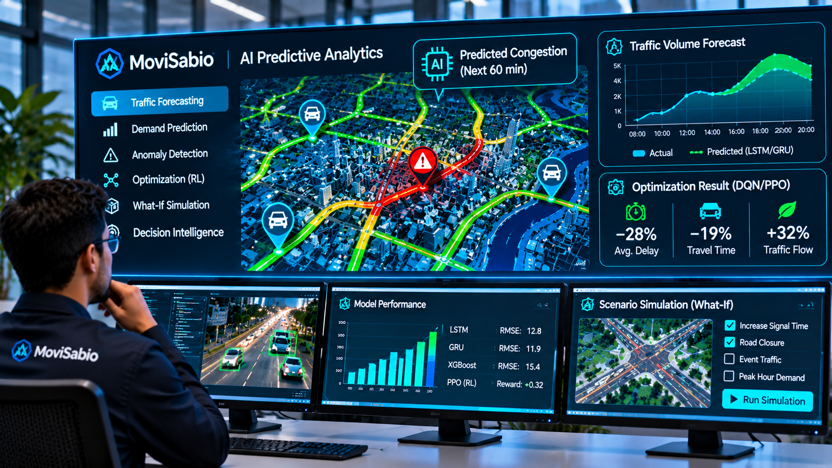
Harnessing sequential deep learning for multi-horizon traffic forecasting and multi-agent reinforcement learning for continuous signal timing optimization.
LSTM / GRU Multi-Horizon Forecasting
ACTIVE DEVELOPMENTRecurrent neural networks ingest historical and rolling traffic time-series to forecast corridor congestion levels 10, 30, and 60 minutes in advance, enabling preemptive signal offset adjustments.
Multi-Agent Deep Reinforcement Learning (DQN / PPO)
ACTIVE DEVELOPMENTEach intersection operates an autonomous reinforcement learning agent. The state space captures approach queue lengths and waiting times; the reward function penalizes aggregate intersection delay and phase-switching overhead.
Technical Specifications & Technology Stack
An exhaustive, transparent engineering matrix detailing every technology, input data source, processing algorithm, and verified development status.
| Domain | Technology | Purpose | Input Data | Processing / Algorithm | Output Data | Status |
|---|---|---|---|---|---|---|
| Programming | Python 3.11 | Core AI models, simulation orchestration, and spatial ETL | Sensor logs, CCTV streams | Asynchronous execution, vectorization | Structured predictions | IMPLEMENTED |
| Programming | C++17 | Low-latency edge inference and controller serialization | Raw frame buffers, serial bits | NTCIP 1202 byte parsing | Actuation commands | ACTIVE DEV |
| Computer Vision | YOLOv8 | Real-time vehicle detection and multi-class classification | H.264/H.265 RTSP streams | Deep convolutional object detection | Bounding boxes, classes | IMPLEMENTED |
| Computer Vision | OpenCV 4.9 | Tripwire line crossing, polygon zones, and video decoding | RTSP video frames | Perspective transform, morphological ops | Lane counts, velocity | IMPLEMENTED |
| Geospatial | OpenStreetMap | Base road network geometry, intersections, and lane rules | OSM XML / PBF extracts | Graph extraction via OSMnx | Road topology graph | IMPLEMENTED |
| Geospatial | GeoPandas & PostGIS | Spatial data transformation, corridor indexing, and querying | Shapefiles, GeoJSON, GPS | R-tree spatial indexing, ST_DWithin | Spatial query results | ACTIVE DEV |
| Simulation | SUMO 1.20+ | Microscopic traffic simulation of vehicles and pedestrians | Network .net.xml, trip routes | Krauss car-following, LC2013 lane change | Vehicle trajectory logs | IMPLEMENTED |
| Simulation | TraCI (Python) | Bidirectional runtime control of SUMO signal phases | Real-time simulation state | TCP socket RPC commands | Dynamic phase changes | IMPLEMENTED |
| Simulation | CARLA | Photorealistic 3D sensor simulation under weather anomalies | 3D town maps, weather states | Unreal Engine 4 physics/rendering | Synthetic camera frames | RESEARCH |
| AI & ML | PyTorch 2.2 | Deep learning model training, reinforcement learning agents | Tensor batches of traffic states | Gradient descent, AdamW optimizer | Trained policy weights | IMPLEMENTED |
| AI Prediction | LSTM / GRU | Sequential multi-horizon traffic congestion forecasting | Historical traffic count series | Recurrent gated cell state transition | 10, 30, 60m predictions | ACTIVE DEV |
| Optimization | MAXBAND | Classical green-wave arterial bandwidth progression | Intersection distances, speeds | Mixed-Integer Linear Programming (MILP) | Baseline green splits | IMPLEMENTED |
| Backend | FastAPI | High-throughput asynchronous REST APIs & WebSockets | JSON payloads, client requests | AsyncIO event loop, Pydantic validation | JSON responses, live streams | IMPLEMENTED |
| Messaging | MQTT | Lightweight telemetry publishing between edge nodes and cloud | Edge sensor readings, alerts | Pub/sub topic hierarchy via QoS 1 | Low-bandwidth telemetry | ACTIVE DEV |
| Hardware Protocol | NTCIP 1202 | Standard traffic signal controller communications | ASC phase hold/omit commands | SNMP/STMP byte serialization | Physical signal timing | PLANNED |
| Infrastructure | Docker & K8s (AKS) | Microservices containerization and automated cluster scaling | Dockerfile, Helm charts | Pod autoscaling, health probes | High-availability deployment | ACTIVE DEV |
| CI/CD & DevOps | GitHub Actions | Automated test execution, linting, and build verification | Git commits and pull requests | Linux runner testing, Docker build | Verified build artifacts | IMPLEMENTED |
6-Layer Enterprise System Architecture
Visualizing the end-to-end data flow: from physical edge cameras and road sensors up through spatial ingestion, deep learning, digital twin simulation, and operator command actuation.
Centralized situational awareness dashboard for municipal dispatchers, interactive Leaflet geospatial map, corridor performance analytics, and emergency preemption consoles.
Closed-loop validation sandbox testing AI-generated signal timing plans against microscopic vehicle behavior in SUMO before physical controller actuation.
Deep learning inference pipelines: YOLOv8 edge vision, LSTM multi-horizon traffic forecasting, MAXBAND linear programming, and Deep Reinforcement Learning (DQN/PPO).
High-availability geospatial data repository hosting PostgreSQL with PostGIS extensions. Executes spatial indexing, corridor network graph queries, and data validation.
High-concurrency asynchronous ingestion cluster handling MQTT telemetry messages from edge devices, RTSP video streaming sockets, and RESTful API data feeds.
Existing physical municipal infrastructure: CCTV traffic cameras, transit bus GPS beacons, inductive loop detectors, weather stations, and local traffic controller cabinets.
Deployment Models & Controller Integration
Flexible hosting options designed to satisfy municipal data sovereignty requirements while maintaining deterministic fail-safe physical signal actuation.
Cloud & On-Premises Flexibility
ACTIVE DEVELOPMENTDeployable on public cloud clusters (Microsoft Azure AKS / AWS EKS), private municipal data centers, or air-gapped on-premises servers to comply with government privacy regulations.
Edge Synchronization & Offline Autonomy
ACTIVE DEVELOPMENTEdge devices run local inference and retain baseline timing configurations. If wide-area network connectivity drops, edge controllers operate independently without interruption.
Controller Integration & Fail-Safe Air-Gap
PLANNED (SAFETY AUDITED)Signal cabinet actuation is executed strictly through authorized NTCIP 1202 protocols. The local controller conflict monitor retains absolute hardware priority; any anomalous command reverts immediately to fixed fallback timings.
Security, Data Governance & Privacy
Built from the ground up for strict regulatory compliance, data sovereignty, and human-in-the-loop operational oversight.
Authentication, Encryption & RBAC
IMPLEMENTEDAll communications are encrypted using TLS 1.3 in transit and AES-256 at rest. Fine-grained Role-Based Access Control (RBAC) separates viewer permissions (analysts) from actuation privileges (authorized dispatchers).
Privacy-by-Design & GDPR/LGPD Compliance
IMPLEMENTEDCCTV video streams are processed exclusively in volatile memory at edge nodes. Video frames are discarded immediately after object detection; no private identities or raw citizen faces are transmitted to central servers.
Research Direction & 4-Phase Municipal Roadmap
A structured progression demonstrating current technical capabilities, near-term development milestones, and long-term quantum-ready territorial research.
Corridor Sandbox Modeling
Ingest road geometry from OpenStreetMap. Calibrate baseline vehicle flows inside the SUMO simulator to establish empirical delay benchmarks.
Shadow Mode Calibration
Connect edge hardware to 5–10 intersections. The AI observes real-time camera feeds and calculates optimal signal splits without physical light actuation.
Active Pilot Actuation
Activate dynamic signal adjustment during off-peak hours first, expanding to 24/7 autonomous coordination under strict MAXBAND fail-safe constraints.
City-Wide Expansion
Unveil the 3D Digital Twin Command Center at City Hall. Scale AI coordination across adjacent arterial corridors and connect public transit priority.
Ready to Model Your Municipality in our Digital Twin?
We collaborate with municipal transport departments, university researchers, and smart-city operators to deploy low-risk, high-impact corridor pilots.