Intelligence for the Territories of Tomorrow.
MoviSabio develops AI-powered territorial intelligence ecosystems that connect geospatial data, mobility, IoT and environmental intelligence to help governments, enterprises and communities make smarter, evidence-based decisions.
Territorial Intelligence Platform
The underlying spatial intelligence ecosystem empowering municipal, mobility, and regional transformation.
"The Territorial Intelligence Platform provides the underlying intelligence ecosystem. MoviSabio Smart City applies this ecosystem to urban mobility, infrastructure management and municipal decision-making."
Territorial Intelligence Platform (TIP)
A multi-agent, spatial intelligence foundation consolidating IoT meshes, AI/ML models, digital twins, and climate telemetry into a unified territorial data plane.
- ✓ Multi-Agent AI & Hybrid Quantum Engine: Predictive traffic modeling & reinforcement learning
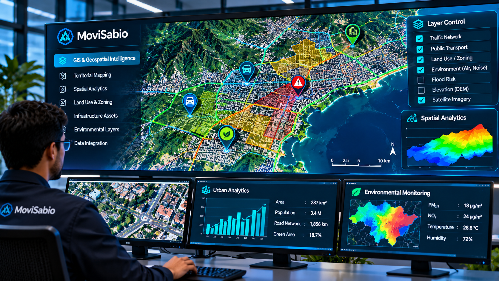
- ✓ Geospatial Intelligence: PostGIS spatial meshes & OpenStreetMap digital twin topology
- ✓ Sensor & Telemetry Ingestion: Hardware-agnostic MQTT, WebSockets & NTCIP 1202
- ✓ Environmental & ESG Analytics: Real-time idling emissions & micro-climate risk tracking
- ✓ Multi-Territory Scope: Extensible from municipal corridors to agriculture & ports
MoviSabio Enterprise Smart City
The practical, municipal implementation of TIP acting as the central nervous system for urban mobility, traffic signal coordination, and municipal emergency response.
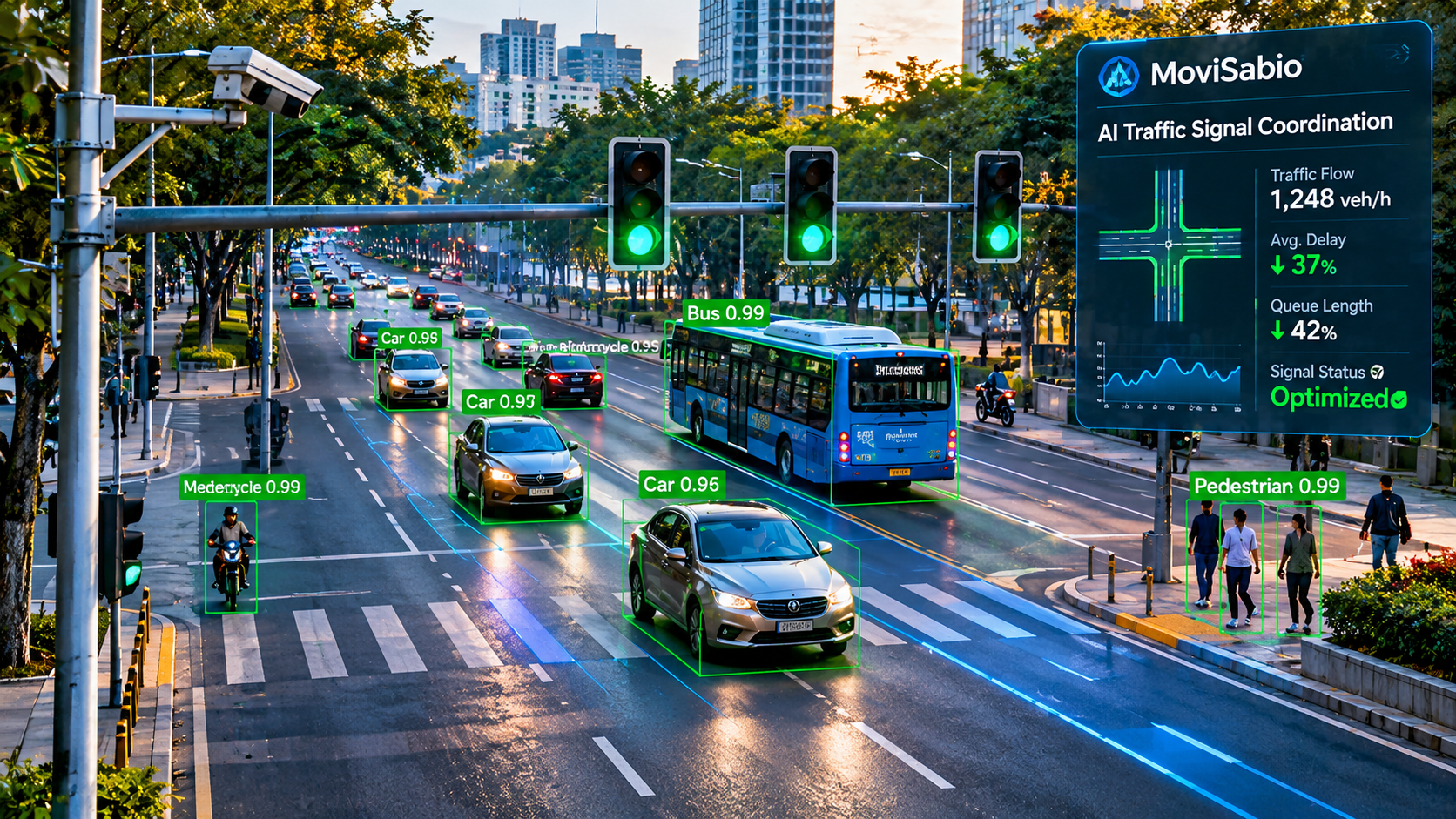
- ✓ Adaptive Signal Control (AITCS): Up to 45% delay reduction via Deep Q-Networks
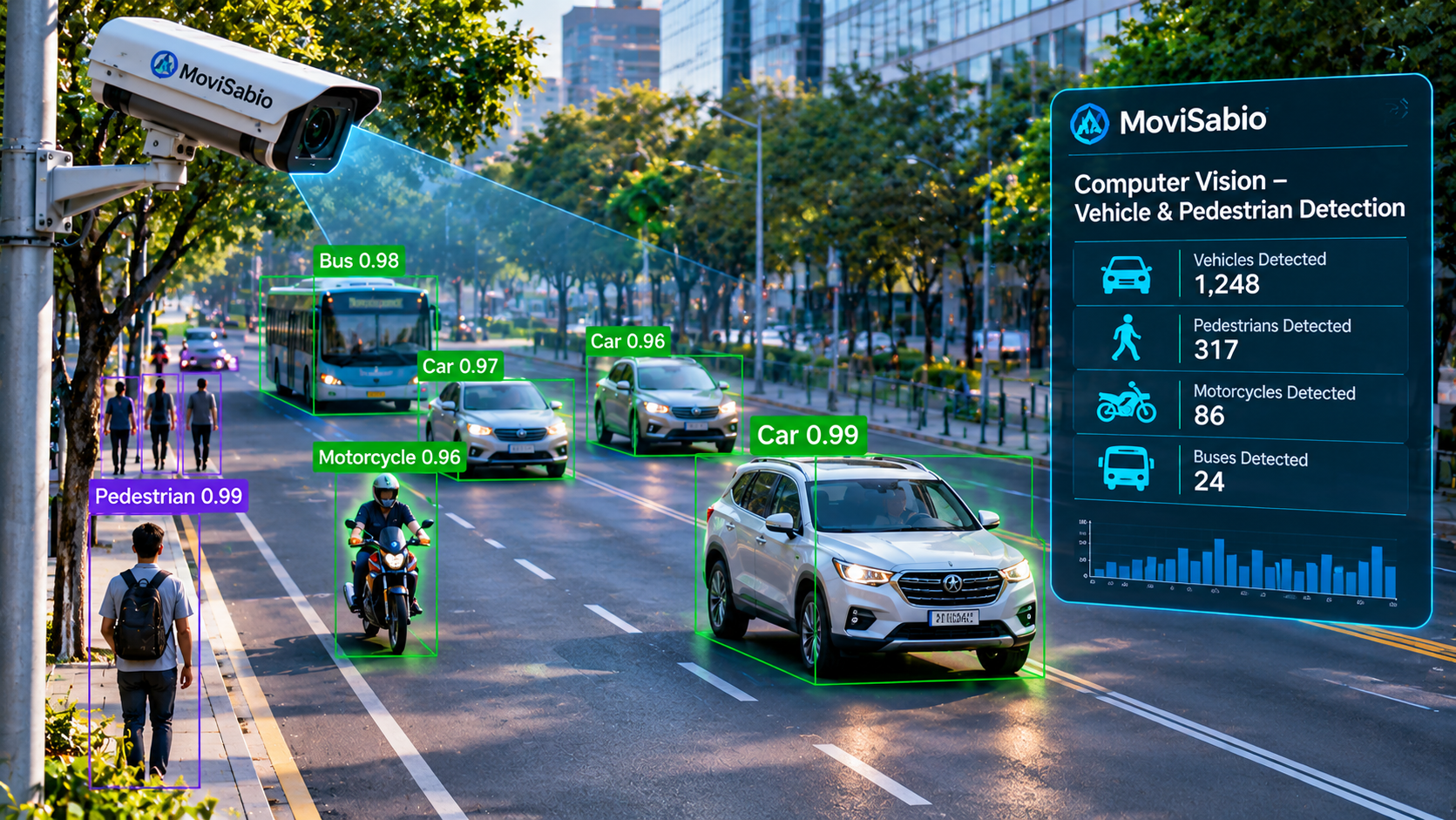
- ✓ Edge AI Computer Vision: YOLOv8 vehicle counting & queue density from existing CCTV
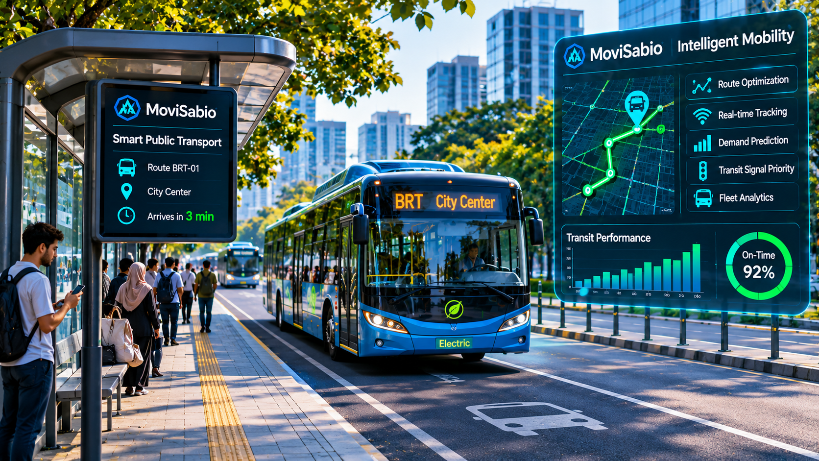
- ✓ Transit & First Responders: Automated green-wave corridors cutting transit delays 30%
- ✓ 3D Digital Twin Command Center: Microscopic SUMO/CARLA simulations for City Hall
- ✓ Municipal Decision Support: Explainable AI confidence scores and incident alerting
MoviSabio Enterprise Smart City
The central nervous system for modern urban environments. Applying the Territorial Intelligence Platform to real-time traffic signal optimization, computer vision vehicle classification, 3D digital twins, and emergency dispatch preemption into a single resilient operating framework.


Adaptive Signal Control (AITCS)
Dynamic green splits and corridor green-wave coordination powered by Deep Reinforcement Learning (DQN), protected by classical MAXBAND safety bounds.
Up to 45% Delay ReductionEdge AI Computer Vision
Taps into existing municipal CCTV cameras via RTSP. Utilizes YOLOv8 object detection for vehicle classification, queue density analysis, and incident alerting.
Zero Sensor Retrofit3D Digital Twin Command Center
High-fidelity virtual corridors in SUMO and CARLA. Enables municipal traffic operators to simulate detours, policy changes, and events before physical field deployment.
SUMO / TraCI IntegratedEmergency Preemption
Automated green-wave corridors for first responders and emergency vehicles, cutting emergency transit response times by up to 30%.
Life Safety PriorityEmissions & ESG Intelligence
Continuous telemetry on vehicle idling times at intersections, calculating real-time CO₂ and PM₂.₅ reduction metrics for municipal climate compliance.
15–30% CO₂ TargetCloud-Native Kubernetes Scale
Enterprise high-availability clustering on Microsoft Azure (AKS) with PostGIS spatial database, Redis caching, and NTCIP 1202 municipal controller integration.
99.9% Uptime DesignExplore the full 12-part architecture guide, feature breakdown, and municipal deployment roadmap.
One Platform, Three Value Propositions
Whether you are a municipal policymaker, an enterprise technology leader, or an institutional investor, MoviSabio provides a purpose-built engagement route tailored to your objectives.
Government & Municipalities
Empowering public administrators, transportation authorities, and municipal planners with real-time evidence to govern urban congestion, infrastructure stress, and climate targets.
- ✓ Urban Mobility Optimization: Adaptive signal control cutting corridor transit delays by up to 45%.
- ✓ Evidence-Based Territorial Planning: SUMO and CARLA digital twins simulating detours and policies before field rollout.
- ✓ Climate Resilience & ESG Compliance: Continuous telemetry on intersection idling times targeting 15–30% CO₂ emissions reductions.
- ✓ Municipal Pilot Opportunities: Rapid 10-corridor validation pilots without costly hardware retrofits.
Enterprise & Technology Partners
Delivering a scalable, cloud-native spatial operating plane for infrastructure operators, transit fleets, logistics hubs, and hardware sensor integrators.
- ✓ Enterprise SaaS Architecture: Cloud-native Kubernetes clustering on Microsoft Azure with 99.9% uptime design.
- ✓ API & Data Stream Integration: Hardware-agnostic MQTT brokers, NTCIP 1202, RTSP CCTV ingestion, and REST/GraphQL APIs.
- ✓ Digital Twin Command Center: Microscopic simulation engines integrated with PostGIS spatial models and Redis caches.
- ✓ Implementation Partnerships: Commercial co-development, hardware certification, and regional distribution alliances.
Investors & Venture Capital
Pioneering the Territorial Intelligence Platform (TIP) category at the convergence of GIS, AI, IoT, Digital Twins, and ESG with high-margin recurring SaaS economics.
- ✓ US$ 1.1 Trillion TAM & US$ 25B SAM: Unlocking massive market potential across Latin America and the European Union.
- ✓ High-Margin Unit Economics: 81% gross margin B2B SaaS architecture with a projected 48% EBITDA margin at scale.
- ✓ Strategic Moat & Category Creation: Differentiated from static GIS (Esri) and costly consulting (Palantir) via accessible SaaS.
- ✓ Valuation Roadmap: 3-stage capital strategy targeting €50.3M ARR and €400M–€750M valuation by Year 10.
Modular Territorial Solutions
Scalable, software-driven solutions addressing urban congestion, public transit priority, agricultural spatial boundaries, and territorial ESG analytics.
Global Operations & Digital Twins
Interactive map of active simulation corridors, digital twin modeling nodes, and European expansion pipelines.
🗺️ Global Geospatial Camera & Digital Twin Map
📺 Live Camera Monitoring Wall
Authorized real-time CCTV traffic monitoring, stream probe diagnostics, and high-resolution surveillance playback.
Switch Active Feed
Loading feeds...📋 Active Camera Telemetry & Technical Metadata
⚡ Traffic Analytics Preparation — Edge YOLOv8 Perception Pipeline
Staged Architecture • Ready for Roadside DeploymentBounding box localization running at INT8 precision on edge GPU acceleration (NVIDIA Jetson / x86).
Multi-modal classification partitioning passenger cars, buses, commercial trucks, motorcycles, bicycles, and pedestrians.
Directional vector tripwires calculating vehicle turnover across approach lanes and turning bays.
Spatial road segment occupancy estimation comparing stationary vehicle area against total lane capacity.
Real-time meter-distance and vehicle-count standing queue accumulation tracking to prevent intersection spillback.
Translates 2D pixel trajectory velocities into ground-plane km/h speed vectors where optical homography is calibrated.
Continuous classification of intersection Level of Service based on volume-to-capacity (v/c) ratios and delay thresholds, automatically signaling upstream corridor metering when LOS degrades below threshold D.
We partner with municipal transportation authorities, regional planning agencies, and university labs.
Project Media Showcase
Explore MoviSabio's AI-powered traffic simulations, digital twin environments, computer vision demonstrations, pilot projects, and engineering activities.
Research & Innovation
Driving forward-looking evidence through rigorous academic partnerships, European grant pipelines, and future-ready quantum computing research.
Hybrid Classical-Quantum Exploration
Preparing for quantum advantage in NP-hard combinatorial territorial optimization (large-scale vehicle routing and multi-regional evacuation corridors) via hybrid QML simulators.
Next-Gen R&DEuropean Grant Pipeline
Targeting non-dilutive research funding through Horizon Europe and EIT Urban Mobility to fund our academic digital twin validation benchmarks and cross-border validation.
Horizon Europe PipelineEvidence-Based Traffic Science
Benchmarking multi-agent reinforcement learning directly against classical MAXBAND and fixed-timing plans inside SUMO simulation grids with real-world OpenStreetMap topologies.
Open BenchmarkAbout MoviSabio
Pioneering borderless spatial intelligence, cloud-native scalability, and measurable ESG impact across global territories.
Global Vision & Mission
We are building the world's leading Territorial Intelligence Platform. Our mission is to scale AI, IoT, and quantum-ready digital ecosystems globally, empowering governments, enterprises, and communities across all continents to make evidence-based, sustainable decisions.
Borderless SaaS Architecture
Engineered for immediate international deployment, our cloud-native platform transforms fragmented territorial data into standardized, actionable intelligence. We enable rapid cross-border scalability without requiring heavy, localized hardware infrastructure.
Worldwide Climate & ESG Impact
Addressing universal challenges in urbanization, agriculture, and resource management. Our predictive AI models help global municipalities and organizations optimize mobility, drastically reduce carbon footprints, and meet rigorous international ESG standards.
Leadership
Multidisciplinary leaders uniting artificial intelligence, public infrastructure policy, and strategic international partnerships.

Alimul Fazal Nabil
- AI & Deep Reinforcement Learning Architecture
- SUMO TraCI Digital Twins & Cloud Fabric
Leandro Patrón
- Municipal & Public Sector Relations
- Infrastructure Engineering & LATAM Policy
Douglas Amante
- International Strategic Partnerships & Consortia
- Commercial Strategy & Enterprise Scaling
Learn how MoviSabio protects municipal data sovereignty, algorithmic explainability, and open science.
Market Opportunity & Unit Economics
US$ 1.1 Trillion
Total Addressable Market (TAM)
Global market potential across Smart Cities, Smart Agriculture, IoT, and Digital Twins.
US$ 25 Billion
Serviceable Available Market (SAM)
Accessible territorial intelligence market across Latin America, Germany, Italy, and the EU.
€50.3 Million
Year 10 ARR Target
Projected revenue scaling across 1,000 active customer accounts with a 48% EBITDA margin.
Category Creation: Territorial Intelligence Platform (TIP)
Integrating GIS, AI, IoT, Mobility, and ESG into a unified SaaS ecosystem.
Strategic Competitive Analysis & Category Creation
The Convergence of 5 Growing Markets
Most existing competitors specialize in only a single layer of territorial management. MoviSabio operates at the convergence of Smart Cities, IoT, GIS, Digital Twins, and Territorial AI.
vs. Esri (ArcGIS)
While Esri dominates traditional GIS mapping, they were not natively designed for real-time IoT mobility, smart agriculture, or integrated ESG analytics. We complement GIS by adding an AI-powered territorial layer.
vs. Palantir
Palantir provides powerful decision intelligence but involves multi-million-euro deployments inaccessible to medium municipalities. We act as an accessible, SaaS-based territorial intelligence layer for Latin America and Europe.
vs. Bentley & Siemens
Legacy industrial giants focus heavily on custom, expensive heavy-infrastructure digital twins. We deliver agility, lower total cost of ownership, and SaaS accessibility extending into agriculture and biodiversity.
Four-Pillar Revenue Architecture
1. SaaS Platform
Core recurring revenue via Starter, Professional, and Enterprise cloud plans (€500–€20,000/month).
2. Data as a Service (DaaS)
Monetizing territorial intelligence reports (air quality, climate, ESG, mobility) at an 85% gross margin.
3. Smart Hardware
Sensors, weather stations, and gateways acting as an accelerated entry mechanism for SaaS contracts.
4. Strategic Consulting
High-value services including Digital Twin architecture, ESG strategies, and EU funding access.
3-Stage Estimated Funding Roadmap
Our capital strategy balances non-dilutive research grants with equity scaling to achieve a €400M–€750M valuation by Year 10:
Stage 1: Validation
(2026–2028)Secure non-dilutive grants (EIC, Horizon Europe, EIT Urban Mobility) to build the MVP and execute anchor pilots in Germany and Uruguay.
Stage 2: Commercialization
(2028–2030)Scale commercial operations across Brazil, strengthen AI/Digital Twin capabilities, and grow recurring SaaS revenue to ~€1.2M ARR.
Stage 3: International Scale
(2030+)Expand across Europe and Latin America, establishing MoviSabio as the leading Territorial Intelligence Operating System (TIOS).
Business-Plan Projections: The financial targets presented above (including the US$ 1.1T TAM, US$ 25B SAM, €50.3M Year 10 ARR target across 1,000 active customer accounts, and 48% EBITDA margin) are forward-looking business-plan estimates derived from addressable smart city, GIS, and IoT market sizing models (Grand View Research, McKinsey Smart Cities). Achieving these targets requires successful execution of our three validation milestones: (1) Stage 1 Corridor A field telemetry and non-dilutive grant validation (2026–2028), (2) Stage 2 commercial municipal SaaS scaling in Latin America (2028–2030), and (3) Stage 3 international enterprise and European expansion (2030+). These metrics are intended solely for institutional discussion and do not constitute an offer of securities or guaranteed returns.
Institutional Capital & Strategic Alliances
Request investor briefs, grant co-funding details, and unit economics modeling.
Submit Your Project Pitch
We believe transformative solutions can originate from university labs, young inventors, or seasoned engineers. Submit your ideas to co-develop or scale with our engineering team.
Partner With MoviSabio
We collaborate actively with municipal departments of transportation, academic research groups, and infrastructure operators globally.
📍 Pilot Operations & Regional Hubs
Latin America: Campinas, Brazil & Montevideo, Uruguay
European Expansion: Munich/Berlin (DE) & Milan (IT)
Asia-Pacific Hub: Singapore & East Asia Scoping Node
✉️ Direct Inquiries
General Information: info@movisabio.com
Technology Office: nabil@movisabio.com
Partnerships: douglas@movisabio.com